

Geographic Information System (GIS) Services
At EnviroScience, our Geographic Information System (GIS) Services are integral to delivering precise, data-driven solutions across a multitude of environmental projects. By harnessing the power of GIS, we provide our clients with comprehensive spatial analyses that inform decision-making and drive successful project outcomes.

Our GIS Expertise
Our team of seasoned GIS professionals specializes in:

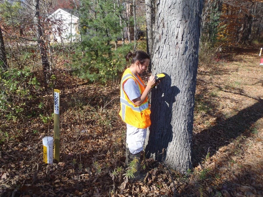
Spatial Data Collection & Management
Utilizing cutting-edge tools to gather and manage geospatial data, ensuring accuracy, quality, and reliability.
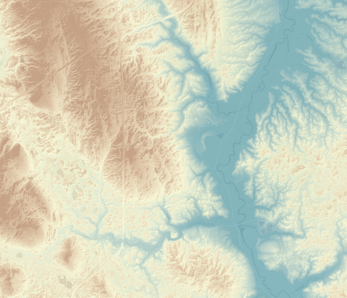
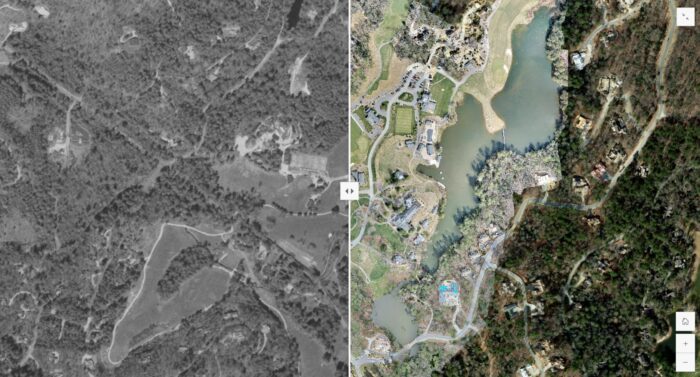
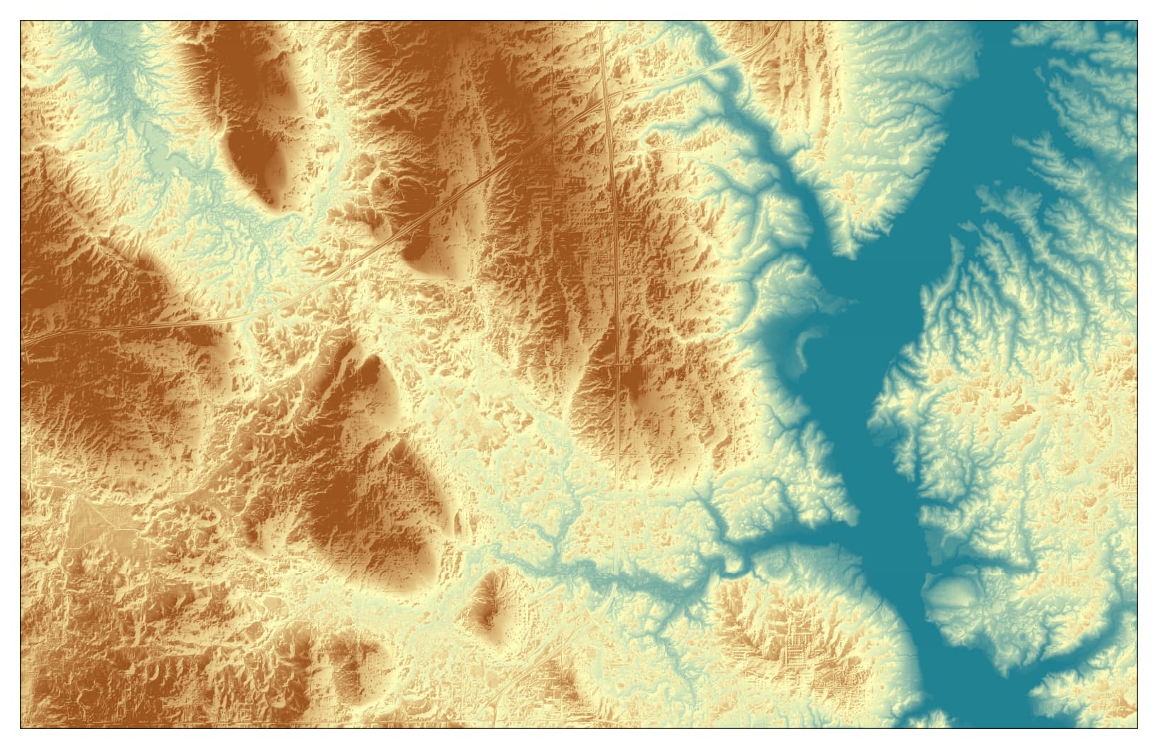
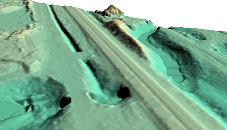
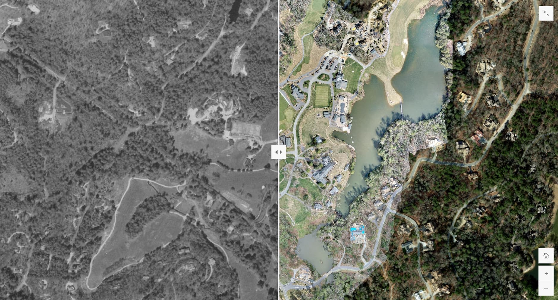
Custom Mapping & Visualization
Creating detailed maps and 2D/3D visual representations that elucidate complex environmental data.
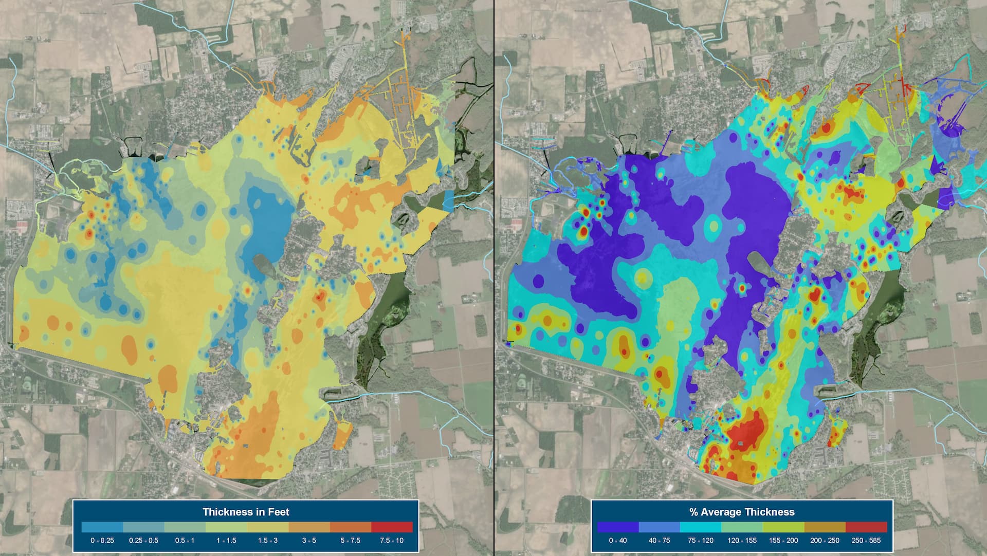
Spatial Analysis & Modeling
Conducting in-depth analyses to identify patterns, trends, and relationships within environmental datasets.
Integration with Environmental Compliance
Aligning GIS products with regulatory requirements to facilitate compliance and reporting.
Mobile & Web-Based Solutions
Developing interactive GIS web applications to visualize a variety of datasets and information in a user-friendly format.

Why Choose EnviroScience for GIS Services?
With over three decades of experience in environmental consulting, EnviroScience stands out for its:

Interdisciplinary Approach
Our GIS services are seamlessly integrated with ecological assessments, restoration planning, and compliance strategies.
Client-Centric Solutions
We tailor our GIS applications to meet the specific needs of each project, ensuring relevance and effectiveness.
Commitment to Innovation
We continuously adopt the latest GIS technologies and geospatial standards to provide state-of-the-art solutions.
Applications Across Diverse Projects
EnviroScience’s GIS services have been pivotal in various projects, including:

Wetland and Stream Delineation
Accurately mapping aquatic resources to support conservation and development planning.
Habitat Restoration Planning
Designing and visualizing restoration initiatives for degraded ecosystems.
Environmental Impact Assessments
Analyzing potential project impacts to inform mitigation strategies.
Stormwater Management
Modeling runoff patterns to develop effective stormwater solutions and managing asset databases.

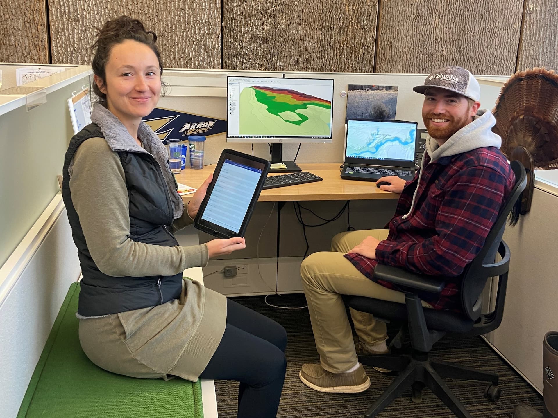
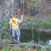
In Action


Collaborate with EnviroScience
Partner with EnviroScience to leverage GIS technology for your environmental projects. Our expertise ensures that spatial data is transformed into actionable insights, guiding your projects from conception to completion. Fill out the form below for more information on our services or to request a quote, and we’ll get back to you within 24 hours. If you need a response within an hour or less, please call us at 800.940.4025.
Few environmental firms in the country retain EnviroScience’s degree of scientific know-how, talent, and capability under one roof. The diverse backgrounds of our biologists, environmental engineers, scientists, and divers enable us to provide comprehensive in-house services and an integrated approach to solving environmental challenges—saving clients time, reducing costs, and ensuring high-quality results.
Our client guarantee is to provide “Excellence in Any Environment,” meaning no matter what we do, we will deliver on our Core Values of respect, client advocacy, quality work, accountability, teamwork, and safety. EnviroScience was created with the concept that we could solve complex problems by empowering great people. This concept still holds true today as our scientists explore the latest environmental legislation and regulations and incorporate the most up-to-date technology to gather and report data.
EnviroScience expertise includes but is not limited to aquatic surveys (including macroinvertebrate surveys and biological assessments); ecological restoration; ecological services (including impact assessments, invasive species control, and water quality monitoring); emergency response; engineering and compliance services; endangered mussel surveys; laboratory and analysis; stormwater management; sustainability services; threatened and endangered species; and wetlands and streams (including delineation and mitigation). Further, EnviroScience is one of the few biological firms in the country that is a general member of the Association of Diving Contractors International (ADCI) and offers full-service commercial diving services.
Enviroscience
Related Information
Wetland Delineation
For over 35 years, EnviroScience biologists have provided wetland delineation...