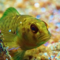
EnviroScience’s lake management services range from full-scale watershed and lake diagnostic studies to invasive aquatic species control and fisheries evaluations.
Our services include, but are not limited to:
- Watershed Assessment
- Water Quality Testing
- Fishery Management
- Aquatic Plant Surveys
- Lake Depth Mapping
- Lakescaping
As with many of our ecological projects, EnviroScience draws on a strong network of university faculty and research staff to support many of our lake projects as consulting scientists. Our partnership with some of the country’s top experts in lake management and rehabilitation allows us to bring their expertise to bear on a wide range of problems in our clients’ lakes and reservoirs.
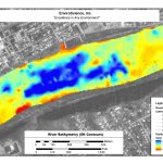
Lake Mapping & Bathymetric Survey
EnviroScience provides cost-effective depth and habitat surveys of lakes, reservoirs, and coastal areas using the latest technology. We maintain an in-house inventory of SyQwest
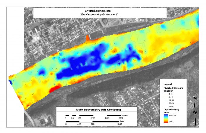
Lake Mapping / Bathymetric Survey
survey-grade depth sounders (±1 inch at 1000 feet of water depth) combined with our Trimble sub-meter GPS units. We have the capabilities to perform a wide variety of specialized marine surveys, including sub-bottom profiling and substrate mapping, where underwater substrate roughness is mapped automatically using high-powered sonar. We also perform side-scan sonar surveys to identify underwater objects such as wrecks, containers, and other obstructions. Combined with our advanced GIS services, these survey tools can provide critical mapping of your project area.
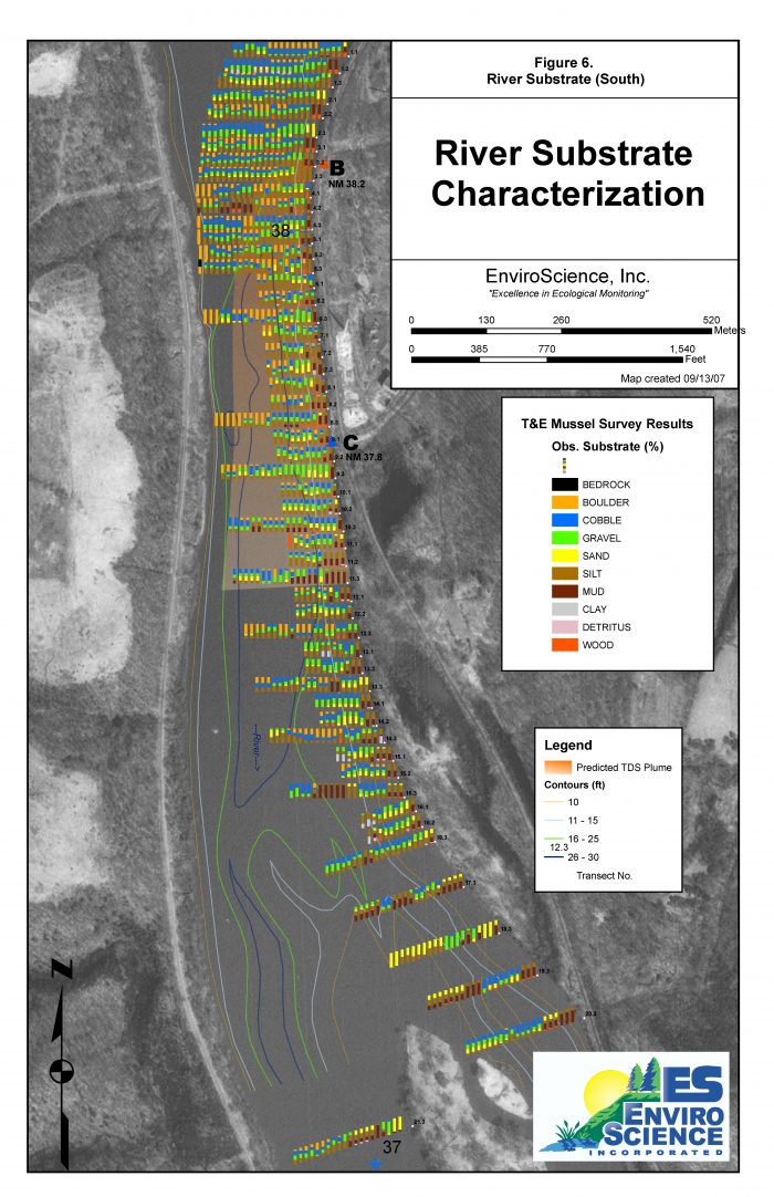
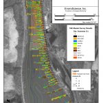
Substrate Characterization
Our key services include:
- Survey-grade depth surveys (SyQwest sounders in-house)
- Sub-bottom profiling
- Diver-performed habitat mapping and characterization
- Substrate mapping
- Side-scan sonar (Starfish Side-scan in-house)
- Aquatic vegetation mapping and identification
- Fishery habitat mapping
- Large-scale thermal profiling (22 thermal arrays in-house)
- Acoustic Doppler Current Profiling (1 unit in-house)
- Remotely Operated Vehicles (ROV)
- Underwater Video Documentation / Inspections
Lake Fisheries & Lake Habitat
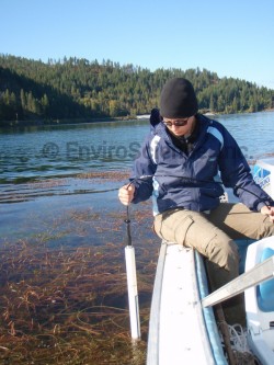
Lake Management
Habitat in reference to aquatic ecosystems generally refers to overhanging vegetation, aquatic plants, woody debris, rock, substrate, and water depth. The quality and distribution of these structures directly influence the living organisms and the entire lake ecosystem.
Conducting a habitat inventory with a fishery analysis can effectively guide management decisions concerning recreational fishing, boating, fish stocking, and water quality.
Our biologists can assess lake and aquatic ecosystem habitats by several innovative methods, including;
- GPS/GIS mapping
- Aquatic and shoreline vegetative surveys
- SCUBA surveys
- Bottom contour mapping
- Bottom typing using hydroacoustics
- Underwater video
A common recommendation given to many lake managers is the enhancement of structures by both artificial and natural means. EnviroScience can aid in the assessment and application of habitat restoration and enhancement programs.
Habitats can be artificially enhanced by man-made structures that are cost-effective and easy to construct. EnviroScience can assist in the design and installation of these structures as well as facilitate any associated permitting requirements. Examples of these structures include vertical and horizontal log structures and brush piles.
Lakescaping
A common natural restoration activity requires landowners to cease mowing activities near shorelines and allow the growth of a natural buffer. The reseeding of natural vegetation is one simple way to decrease shoreline erosion and provide shade and cover for juvenile fish. EnviroScience can design an aesthetic natural buffer zone using native plants in a process called Lakescaping. Lakescaping is a viable solution for restoring the natural habitat to help many native species of birds, mammals, and fish thrive.
Watershed Analysis & Assessments
Lake Management
Lake health affects property owners in numerous ways. Poor lake health affects recreation activities, property values, personal health, and aesthetic beauty. Often times lake quality is a direct result of land use and drainage patterns within the watershed. A thorough understanding of the type of activities that affect your lake is a powerful weapon against degradation.
Watershed analysis is the systematic and scientific approach to characterizing and evaluating variables that may directly or indirectly influence lake quality. EnviroScience biologists assess watersheds using GPS and GIS mapping technology, water quality studies, field surveys, land use assessments, and historical research.
Our watershed analysis reports highlight problem areas and summarize current lake status largely by the use of ArcView® GIS mapping software. The resulting information and maps are very beneficial for making accurate management decisions concerning lake quality issues and our reports provide background information for comparison in the future.
Fishery Management
Fishery Evaluations: A Valuable Management Tool
EnviroScience biologists have extensive experience conducting full-scale fishery evaluations from small private ponds to Lake Erie. Our biologists have sampled over 4,000 locations throughout the United States, generating an exceptional knowledge base of the biology and ecology of fish communities. Three factors are needed to sustain a viable fishery in any system:
- Habitat: water quality, cover, plants, depth, substrate
- Food: invertebrates, baitfish, plankton
- Reproduction: adult survival, spawning habitats
Fishery evaluation – fish survey followed by a detailed report containing comprehensive data analysis, imagery generation, and management recommendations where applicable. An analysis of these factors, in combination with abundance and diversity data, is an excellent method of assessing fishery and lake health. Fisheries are sampled using a variety of techniques, including electrofishing, hoop netting, seining, gill netting, Global Positioning System technology, and Geographic Information System software. Oftentimes, several methods are used simultaneously to ensure adequate sampling in all habitats. For example, hoop nets target bottom-dwelling species sometimes missed by electrofishing.
EnviroScience experts analyze the data to assess fish population dynamics and health, which are used to develop best management plans for stabilizing or improving the fishery. Recommendations may include stocking and habitat improvement. Our proactive approach encourages close work and communication with the client, lake association, and other principal stakeholders. Each project is tailored to the specific needs and goals of the lake.
- Nuisance species management – removal of unwanted fish species such as carp, large gizzard shad, etc.
- Fish surveys include the collection of fish for various purposes, such as tissue analysis or consumption advisories.
- Bathymetric surveys using the latest in Global Positioning Systems
- Habitat evaluation and improvement recommendations and design
- Comprehensive water quality sampling and lake diagnostics
- Qualitative and quantitative analysis of zooplankton, phytoplankton, and ichthyoplankton
In Action
-
-
-
-
-
-
-

-
-
-
Substrate Characterization
-
-
Lake Mapping / Bathymetric Survey
Need help with your project?
Our experts are here to discuss your needs and how we can help you move your project forward. Fill out the form below for more information on our services or to request a quote, and we’ll get back to you within 24 hours. If you need a response within an hour or less, please call us at 800-940-4025.
Few environmental firms in the country retain EnviroScience’s degree of scientific know-how, talent, and capability under one roof. The diverse backgrounds of our biologists, environmental engineers, scientists, and divers enable us to provide comprehensive in-house services and an integrated approach to solving environmental challenges—saving clients time, reducing costs, and ensuring high-quality results.
Our client guarantee is to provide “Excellence in Any Environment,” meaning no matter what we do, we will deliver on our Core Values of respect, client advocacy, quality work, accountability, teamwork, and safety. EnviroScience was created with the concept that we could solve complex problems by empowering great people. This concept still holds true today as our scientists explore the latest environmental legislation and regulations and incorporate the most up-to-date technology to gather and report data.
EnviroScience expertise includes but is not limited to: aquatic survey (including macroinvertebrate surveys and biological assessments); ecological restoration; ecological services (including impact assessments, invasive species control, and water quality monitoring); emergency response; engineering and compliance services; endangered mussel surveys; laboratory and analysis; stormwater management; threatened and endangered species; and wetlands and streams (including delineation and mitigation). Further, EnviroScience is one of the few biological firms in the country that is a general member of the Association of Diving Contractors International (ADCI) and offers full-service commercial diving services.


