



 By Anna Piazza, GIS Operations Manager, EnviroScience
Utility vegetation management has always balanced reliability, safety, and environmental stewardship. Utilities are expected to deliver safe, consistent service while navigating regulatory frameworks, sensitive landscapes, aging assets, and extreme weather. As projects scale in size and geographic extent, anticipating environmental risk before field crews mobilize has become both a necessity and a strategic advantage.
Geographic Information Systems (GIS) has become a core spatial tool for identifying environmental risk hotspots across utility projects early and proactively preventing impacts before work even begins. Rather than relying solely on site-scale assessments or reactive mitigation, GIS allows us to see patterns across the landscape, anticipate risk, and support better decision-making in the office that translates directly to safer, more efficient field execution.
What Are Environmental Risk Hotspots?
Environmental risk hotspots are locations where utility work or routine vegetation management activities intersect with sensitive natural, cultural, or regulatory features in a way that increases the likelihood of environmental impact or compliance issues. These risks are not limited to a single utility sector or project type and can arise during construction, inspection, maintenance, or vegetation management activities across electric, water, wastewater, gas, and telecommunications systems.
Some common examples include:
- Steep slopes with high erosion potential that could be disturbed during access or excavation
- Streams, wetlands, and floodplains near utility assets
- Soils prone to instability or sediment transport
- Known or potential cultural and archaeological resources
- Protected habitats or species occurrence areas
- Areas with limited access that increase the likelihood of navigation outside the project corridor
On an individual level, these features are well understood by environmental specialists. However, the challenge for utilities is understanding how they overlap with planned work across large service areas and how those intersections change based on scope, season, or weather conditions. This is where GIS provides us with a unified, intelligence-driven spatial support tool needed to identify these overlaps early and consistently.
Shifting Environmental Risk Management Upstream
Historically, environmental risk in utility projects has often been addressed late in the planning process or even after work has begun. Field crews encounter unexpected site conditions, environmental experts are called in reactively, and mitigation measures are implemented under schedule pressure. Using GIS can shift environmental review into project planning, scoping, and scheduling so risks are identified and addressed before field crews mobilize. This proactive model reduces surprises in the field and allows environmental protection measures to be designed intentionally rather than defensively.
Essential GIS Data Layers That Inform Risk Identification
GIS allows organizations to integrate multiple data sources into a single spatial framework that supports planning, operations, and compliance. While specific layers vary by project type and region, several core categories should be consistently reviewed across all utility projects:
- Topography and Slope Models: High-resolution elevation data allows users to identify steep or unstable slopes that may be prone to erosion or access challenges.
- Soils Data: Soil classifications help predict erosion potential, compaction risk, and suitability for different construction or access methods.
- Wetlands and Other Water Resources: Streams, wetlands, floodplains, and drainage features are mapped to identify areas requiring buffers, permits, or specialized controls.
- Environmental Constraints: Protected species areas, conservation easements, and regulatory boundaries are incorporated where applicable.
- Cultural and Historical Resources: Known archaeological sites and areas of cultural sensitivity are reviewed early to avoid inadvertent impacts.
- Operational Data: Utility assets, project footprints, ROW boundaries, access routes, and staging areas are included to understand where work intersects with sensitive features.
By visualizing these datasets together, GIS transforms individual data points into a comprehensive analysis of environmental risk for early detection and targeted work planning.
Identifying Hazardous Slopes Before Field Mobilization
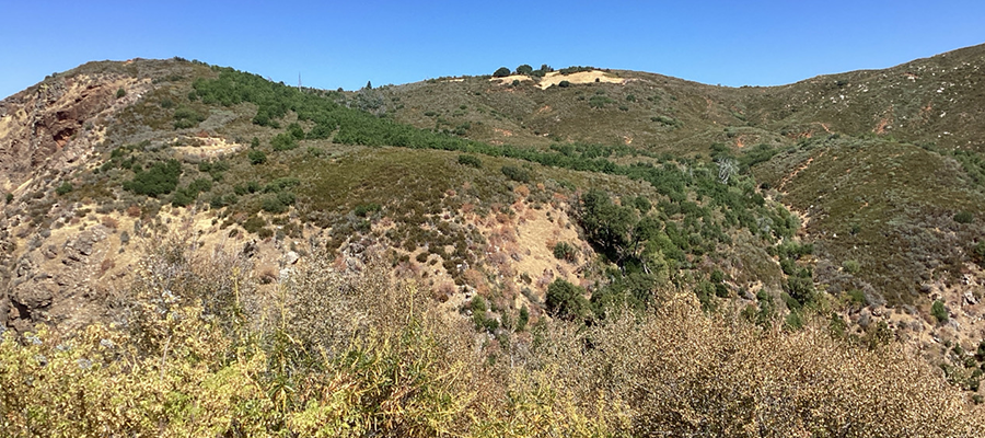
On a recent utility project in northern California, GIS analysis played a critical role in identifying potential safety risks or inaccessible areas before crews were dispatched. During the planning phase, we overlaid the utility ROW boundaries and infrastructure with slope and aspect data our team derived from digital elevation models.
The analysis highlighted areas where slopes exceeded thresholds commonly associated with risk. While these areas were not immediately obvious from asset maps alone, the geospatial review revealed hazardous slopes that could impede field surveys. Identifying these risks in the office offered several potential key benefits:
- Access route and transect placement adjustments to avoid some of the steepest slopes where feasible
- Work method modification to reduce ground disturbance
- Field crew briefings on site-specific sensitivities before mobilization
As a result, our team avoided project delays due to uncertain circumstances and minimized environmental disturbance.
Reviewing Geospatial Data Layers on Every Utility Project
Beyond project-specific analyses, GIS supports standardized environmental and cultural reviews across all our utility projects, regardless of size or scope. The same analytical framework used for a single project can be applied across a utility’s entire service area. Before any field activity begins, project footprints are screened against environmental and cultural datasets to identify potential constraints, helping to answer several critical questions:
- Are there known cultural resources within or near the work area?
- Do environmental buffers or permit conditions apply?
- Are there access limitations that could push crews into sensitive areas?
When risks are identified early, project teams can coordinate with environmental specialists, regulators, or cultural resource professionals proactively. In many cases, this avoids last-minute work stoppages and fosters stronger relationships with project stakeholders. By reviewing environmental and cultural layers embedded into project workflows and as new data becomes available (e.g., environmental surveys or field-collected observations), it can be integrated back into the system to continuously improve future analyses. Over time, this creates a feedback loop where field surveys inform planning, and planning improves field execution.
Turning GIS Insights into Field-Equipped Guidance
The value of GIS lies not only in spatial analysis but in communication with project personnel. By taking environmental risk information and translating that into guidance which field crews can understand and apply to their work.
Project Highlight: GIS-Driven Environmental Risk Analysis for Fiber Network Installation
EnviroScience recently supported a major utility initiative to install an underground fiberoptic network across Summit County, Ohio — an effort designed to strengthen emergency response communications and expand critical community infrastructure. The proposed utility corridor spanned more than 130 miles of on- and off-road ROW, intersecting a wide range of environmental features and regulated resources.
To streamline planning and reduce risk, EnviroScience used GIS to guide field strategy and decision-making from the outset. By integrating wetland inventories, hydrology layers, listed species datasets, and land management boundaries, GIS provided a clear picture of where environmental constraints overlapped with the developing design. This insight allowed staff to quickly identify high-probability areas for aquatic resources and assign them to the most efficient survey routes. Areas with potential for endangered species were flagged and assigned to biologists with species-specific expertise, allowing crews to confidently rule out unsuitable habitat and focus effort where it mattered most. This approach significantly accelerated data collection and reduced unnecessary disturbances.
GIS also proved invaluable during design refinement. As alternative routes and re-routes were evaluated, our team provided rapid environmental screenings and permitting guidance using the spatial dataset. The final alignment was adjusted to avoid all wetland, stream, and protected species impacts ultimately limiting regulatory requirements.
By combining GIS analysis with targeted field expertise, EnviroScience helped the client proactively identify environmental risk hotspots, minimize permitting needs, and deliver a resilient design that met both utility goals and resource protection standards. The project demonstrates how integrated GIS workflows can transform large-scale ROW planning from reactive mitigation to informed prevention.
Benefits Across Utility Operations
Using GIS to identify environmental risk hotspots delivers tangible benefits across utility organizations, including better regulatory compliance, fewer outages and accidents, and more accurate asset planning.
- Reduced Environmental Incidents: Proactive identification leads to fewer impacts and compliance issues.
- Improved Project Efficiency: Early risk awareness reduces delays, rework, and emergency mitigation.
- Better Field Outcomes: Crews arrive informed, prepared, and confident in sensitive environments.
- Stronger Documentation: GIS-based analysis provides a defensible record for audits and regulatory reporting.
Overall, an integrated GIS system supports a shift in organizational culture from reactive environmental management to prioritizing preventative environmental stewardship.
Looking Forward
As utilities continue to modernize or replace aging infrastructure and expand services, the environments in which we work will only grow more complex. GIS provides a powerful, practical way to understand that complexity and respond to any issues sensibly. By identifying environmental risk hotspots early, utilities can protect natural and cultural resources, support their field teams, and deliver projects in a timely and efficient manner. Environmental stewardship and operational reliability are not competing priorities — they are mutually reinforcing goals when supported by the right tools. In an industry where preparation is everything, GIS helps ensure that the most important environmental decisions are made before boots ever hit the ground.
This article was originally published in the 2026 March/April edition of the UAA Newsline.
Few environmental firms in the country retain EnviroScience’s degree of scientific know-how, talent, and capability under one roof. The diverse backgrounds of our biologists, environmental engineers, scientists, and divers enable us to provide comprehensive in-house services and an integrated approach to solving environmental challenges—saving clients time, reducing costs, and ensuring high-quality results.
Our client guarantee is to provide “Excellence in Any Environment,” meaning no matter what we do, we will deliver on our Core Values of respect, client advocacy, quality work, accountability, teamwork, and safety. EnviroScience was created with the concept that we could solve complex problems by empowering great people. This concept still holds true today as our scientists explore the latest environmental legislation and regulations and incorporate the most up-to-date technology to gather and report data.
EnviroScience expertise includes but is not limited to aquatic surveys (including macroinvertebrate surveys and biological assessments); ecological restoration; ecological services (including impact assessments, invasive species control, and water quality monitoring); emergency response; engineering and compliance services; endangered mussel surveys; laboratory and analysis; stormwater management; sustainability services; threatened and endangered species; and wetlands and streams (including delineation and mitigation). Further, EnviroScience is one of the few biological firms in the country that is a general member of the Association of Diving Contractors International (ADCI) and offers full-service commercial diving services.