Norwalk, Ohio
- City of Norwalk
- Key Services Provided:
- Bathymetry Survey
- Drone Aerial Topography Survey
- Bathymetry Mapping
- Volumetric Analysis of Storage and Sediment
- Project Duration: Fall 2020
- Project Cost: $8,700
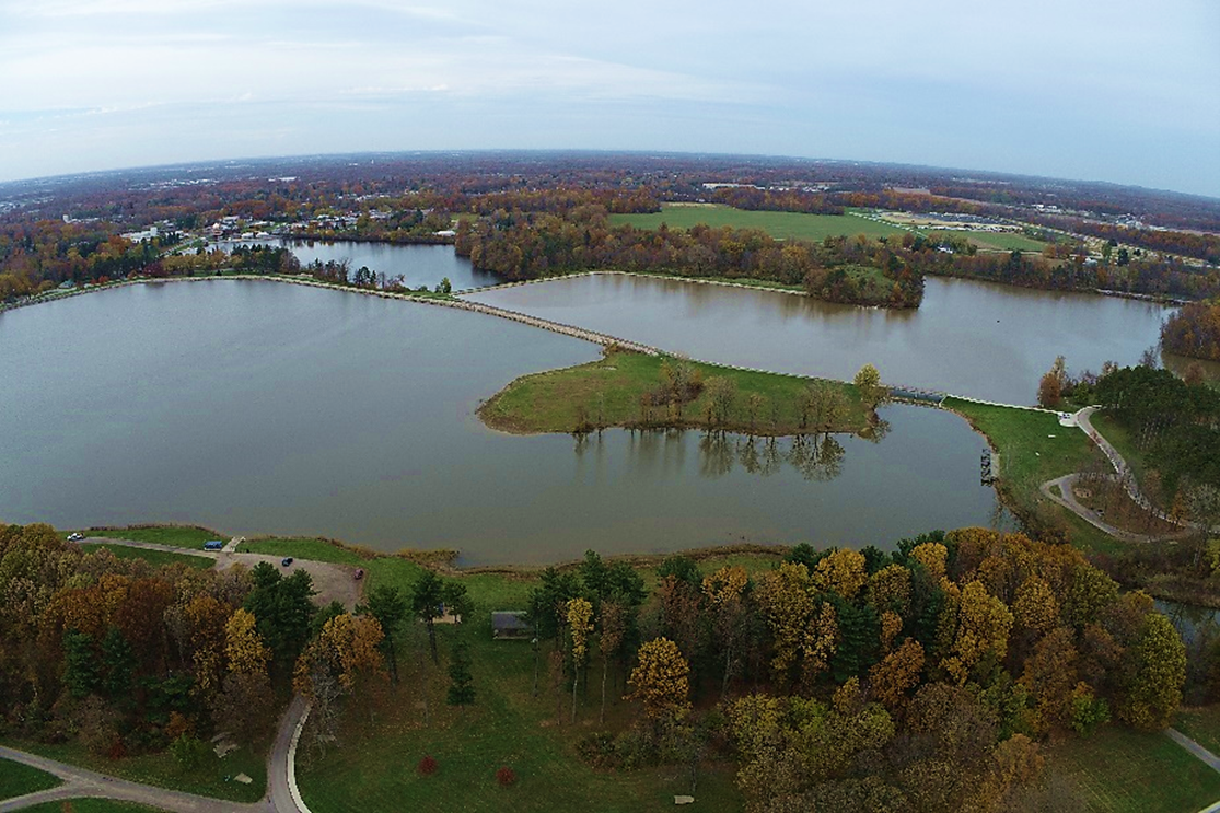
Aerial View of Memorial, Upper, and Lower Reservoirs in Norwalk, OH.
The City of Norwalk contracted EnviroScience, Inc. to perform a bathymetric survey of three reservoirs in fall of 2020. The objectives of the survey were to map the lake bottoms, compare the current condition to prior bathymetric surveys, and to perform a volumetric assessment comparing the current volume of the reservoirs to prior surveys in terms of sedimentation.
EnviroScience performed the bathymetric survey using a boat-mounted survey-grade echosounder and GNSS receiver to achieve the highest possible accuracy for lake bottom elevations and horizontal positioning. Additionally, EnviroScience used an RTK-enabled drone to obtain survey-grade photogrammetry data on the exposed shoreline, as the Memorial Reservoir was drawn down several feet. The sonar data were combined with the drone data to generate a TIN surface, which was used to calculate the current volume of the reservoir and provide a means to estimate volumes at both lower and higher water level stages.
EnviroScience produced a sediment map that showed depth comparisons between the current condition, and that of a historic bathymetric survey. The volumetric assessment showed that there were several areas of sediment accumulation, which can now be easily targeted in potential future dredging operations, or for sediment sampling and characterization. The survey will be used by the City of Norwalk as the baseline survey with which to compare more bathymetry surveys in the future.