Little Cuyahoga Watershed, Akron, Ohio
- City of Cuyahoga Heights
- Key Services Provided:
- Mitigation Plan Development
- Mitigation Plan Coordination
- Stream Restoration
- Wetland Restoration
- Construction Oversight
- Invasive Species Management
- Project Duration: March 2017 – October 2020
- Project Cost: $425,000.000

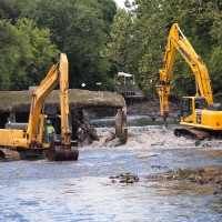
EnviroScience, along with GPD Group and RiverReach Construction, provided design/build full delivery mitigation services to the City of Cuyahoga Heights by working with the Western Reserve Land Conservancy and the City of Akron as site property holders. The EnviroScience team was instrumental in developing the mitigation concept, coordinating with the landowners, and finding a match for the mitigation needs with Cuyahoga Heights. The project will mitigate losses to jurisdictional features by restoring 1,574 LF of stream, creating 0.7 acres of wetland, and enhancing 0.8 acres of wetland. This project required an FAA permit, which was authorized in early October 2019, since the project resides in the FAA jurisdiction for the Akron Municipal Airport.
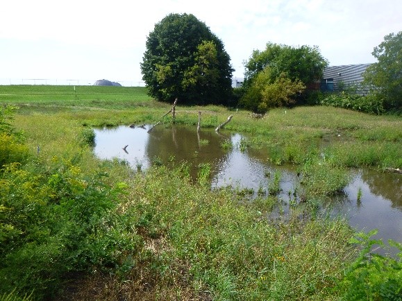
Historically, the Adam’s Run watershed consisted of forested and wetland plant communities. Over the past 100 years, the watershed has been heavily urbanized, which has resulted in channelization, degradation of the riparian zone, stormwater inputs, and artificial drainage practices. These stressors have resulted in altered stream morphology, poor in-stream habitat, and low diversity.
The Adam’s Run Restoration project provides an excellent opportunity to restore an impaired tributary to the Little Cuyahoga River and create much-needed floodplain storage and riparian and habitat improvement. From a morphological, biological, and habitat perspective, Adam’s Run functions poorly. Fortunately, the site offers specific opportunities that, if restored, could dramatically increase functionality. The most limiting characteristics of Adam’s Run are the channelized stream alignment and low gradient. However, the culvert invert at Triplett Blvd. is suspended approximately 3.0 ft above the streambed, thereby creating an opportunity to raise the streambed to increase the overall stream gradient. This approach of raising the gradient is suitable for this site due to the historic floodplain. The project entails a combination of re-attachment and excavation of a new floodplain. This floodplain serves as a foundation with a more natural meander pattern extending from Triplett Blvd to the Archwood pedestrian bridge. Within the new floodplain, particularly in the southern portion of the site, additional restored wetlands are proposed.