The St. Joseph River Wetland Conversion Project
by Ann Gilmore, Senior Ecologist / Project Manager
As May 2021 comes to an end, I am closing a short, intense, and satisfying chapter in my professional life. This month marks the completion of two large wetland and stream restoration projects I have been working on with my team over the past year. Black Swamp Conservancy awarded the Ecological Restoration Team at EnviroScience, Inc. the St. Joseph River Confluence Restoration and the St. Joseph River Farm and Floodplain Restoration projects in the spring of 2020. My prime focus since the award has been to restore these sites. Both funded by Governor DeWine’s H2Ohio initiative, these projects focus on restoring wetlands and streams, improving habitat, reducing sedimentation and erosion, and decreasing nutrient pollution in the Western Lake Erie Basin. The end of May marked the final wetland plantings, and we are keen to watch these sites recover in the coming years.
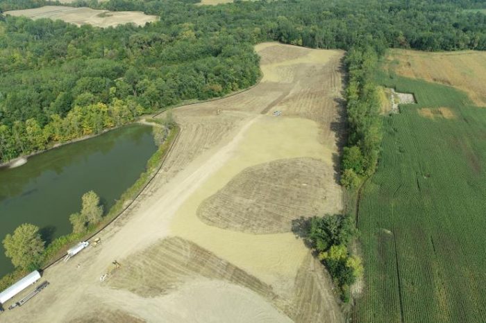
(Drone image by EnviroScience, Jeff Niehaus)
We were excited as a company when Governor DeWine established the H2Ohio program, emphasizing wetland restoration as a critical component to addressing water quality issues within the western basin of Lake Erie. As biologists, we recognize the understated importance of wetlands on the landscape, not only as biodiversity hotspots and wildlife habitat, but for the critical ecosystem functions they serve, including flood control, erosion control, nutrient attenuation, and overall water quality improvement. When the Black Swamp Conservancy requested proposals for these projects, we immediately hopped in the car to visit the sites!
These projects are located on former agricultural land, entirely or partially within the 100-year floodplain of the St. Joseph River in Williams County, Ohio. The St. Joseph River originates in southwestern Michigan and flows through northwest Ohio joining the St. Mary’s River in Fort Wayne, Indiana, to form the Maumee River. The St. Joseph River drains approximately 694,400 acres of primarily agricultural land, with about 80% of the watershed in cropland, pasture, or forage. The Black Swamp Conservancy identified these projects because of their potential for hydrologic restoration and their proximity to higher-quality forested riparian habitat along the river.
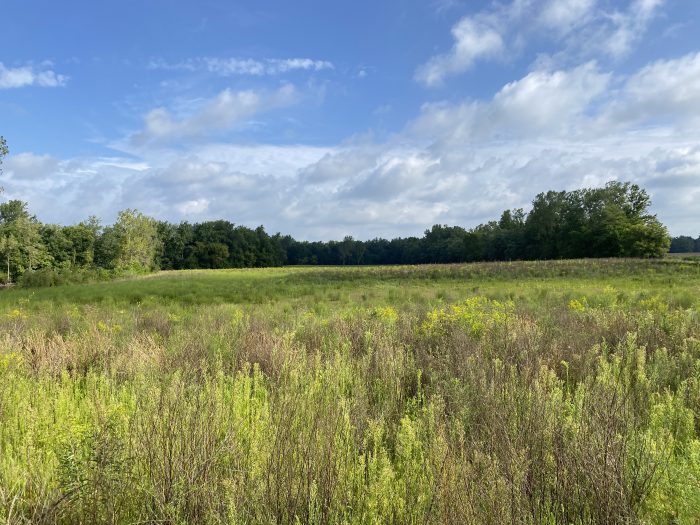
This article will discuss the first project we completed with our teaming partner, RiverReach Construction: the St. Joseph River Wetland Conversion Project. This project is located at the confluence of the West Branch of the St. Joseph River and the river’s main stem. Before the restoration, the site consisted of a 19.5-acre agricultural field that was often too saturated to farm, and a 20-acre field of wet grassland enrolled in the Natural Resources Conservation Service’s Conservation Reserve Program, both of which the Black Swamp Conservancy identified for wetland restoration. Hydric soils underlay approximately 33 acres of the restoration areas, and the entire site is within the 100-year floodplain of the St. Joseph River. A quick look at historical aerials indicated that this site is frequently saturated and inundated when river levels rise. Adjacent to these fields, the site consists of over 60 acres of high-quality forested floodplain wetlands.
Our team first visited the site in January 2020 to gather preliminary site data and refine our concept for the requested proposal. During this site visit, I was impressed by the site’s intact forested wetlands and hydrologic connectivity. I understood why this project had excellent restoration potential, even with existing modifications. The site contained a great deal of hydrologic connectivity, a predominance of hydrophytic plants, and hydric soils. From a wetland restoration perspective, this site is ideal for achieving the project goals with minimal disturbance by improving upon existing conditions.
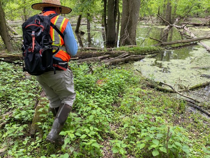
After we were awarded the project, we held a kickoff meeting on Zoom in the early days of the pandemic shutdown, each calling in from our homes. I was nervous that the pandemic would set our aggressive schedule back with so many unknowns of the imminent future. The grant funding required that this project be completed by the end of May 2021. Luckily, we could return to the site in May 2020 to delineate the existing wetlands and collect survey data, both on the ground and with our drone. We used this information to further refine the restoration design and aid in any state or federal wetland permitting.
Typically the work we were proposing would require authorization from the U.S. Army Corps of Engineers and Ohio EPA; however, because of recent changes to federal wetland regulations, the fields in agricultural production and the Conservation Reserve Program were exempt from permitting. Nevertheless, we did coordinate our wetland delineation and restoration design with both agencies. However, the regulatory changes enabled us to move forward without a wetland permit and meet the project deadlines given the other project components.
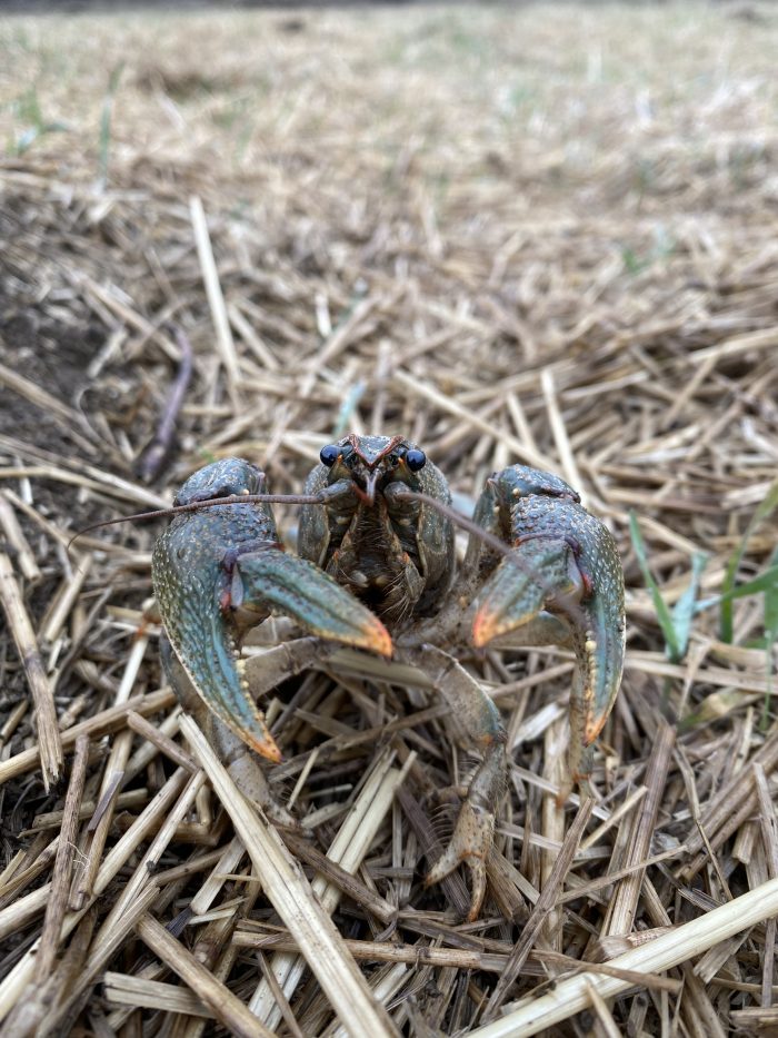
Going into the project, we were aware of a nearby historical record of the federally threatened Copperbelly Watersnake (Nerodia erythrogaster neglecta), and because of the site’s proximity to a large known population of the snake, we initiated coordination with the U.S. Fish and Wildlife Service (USFWS) regarding this species. EnviroScience herpetologists and the USFWS performed presence/absence surveys for this species before construction. Although we did not find any Copperbelly Watersnakes onsite, the fields were inundated with crayfish burrows where copperbellies hibernate near the water table in floodplain wetlands from October through April. Additionally, one of their common prey species—cricket frogs—breed onsite. Because of these factors, we were under a deadline to break ground in August and complete restoration work before the snake’s hibernation period.
As a final level of protection, we installed a snake exclusion fence around the restoration area and checked the fence daily prior to using heavy equipment. Although we did not find copperbellies at the site, the Eastern Garter Snake population was thriving there, so we moved this species offsite where construction activities would not affect them.
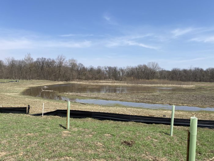
The construction component of this project was relatively straightforward; much of the work involved minor scraping of the site to achieve a suitable elevation for wetland development. We removed large concrete slabs previously used to stabilize the riverbanks and created natural inlets to allow the river to flood the fields during high water events to improve hydrologic connectivity. We restored an old oxbow wetland onsite and re-used the trees we cut for the inlets as woody habitat features in the restored wetlands. We hand-seeded the site with native seed mixes in October 2020 and returned this spring to plant live stakes, containerized shrubs and trees, and wetland plugs. The finished project restored approximately 19 acres, creating around 17 acres of wetland, and reforested approximately 11 acres.
Despite this year’s dry spring, the site is already functioning well to capture floodwater and retain it on the landscape. The wetlands in both fields show recovery, and we anticipate that during typical spring weather, the wetlands will capture more of those early spring floods and retain the water on the landscape. Our crews have seen a positive response from the wildlife as well. The birdlife is rich onsite, and we have observed Sandhill Cranes, Wood Ducks, Bald Eagles, and Woodcocks in or near the restored wetlands. The cacophony of breeding songbirds and amphibians is not lost on the casual visitor. Additionally, our pollinator specialist found a Brown-belted Bumblebee nest (Bombus griseocollis) with honey pots in the Conservation Reserve Program field.
Over the next two years, our team will monitor the project and perform invasive species management onsite. We are delighted to watch this site recover and establish itself. In addition to improving water quality in the Western Lake Erie Basin, my secret hope is that someday a Copperbelly Watersnake may find itself a happy home there.