EnviroScience Uses New Sonar Technology to Improve its Underwater Inspections
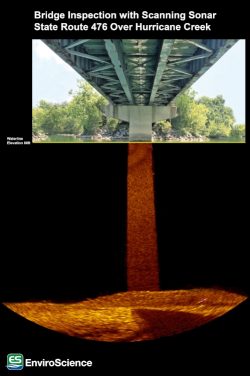
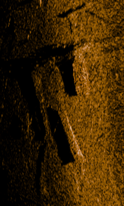
EnviroScience, Inc. has been conducting underwater inspections since 1998 and is now qualified in underwater imaging and modeling via side scan sonar and scanning sonar. Sonar (Sound Navigation and Ranging) is a technology that utilizes sound waves to view underwater environments. Side scan sonar (Left image), usually mounted to or towed behind the boat, scans the river bottom. Scanning sonar (Right image) remains stationary underwater and can scan 360 degrees. This technology is rapidly growing and developing – completely changing the way submerged settings are viewed and studied. With this technology, it is now possible to inspect submerged structures that were previously impossible due to hazardous or murky conditions. Bridge inspections, scour volume calculations, substrate mapping, survey-grade depth surveys, object location, search and recovery, diver safety, and more can be done efficiently and effectively.
EnviroScience has several capable divers trained in sonar deployment and operations. Additionally, EnviroScience GIS analyst Rachael Goliver received in-depth training on the science behind acoustics and sonar technology, how to deploy and repair sonar hardware, and how to best process sonar imagery with multiple software packages. She has also been trained in the field for hands on experience with the Mesotech 1000 Scanning Sonar, Starfish 450F, and Dual Axis Scanning Sonar. EnviroScience recently used this technology to inspect bridge piers for Tennessee Department of Transportation.
Give us a call at (800) 940-4025 to discuss how this technology can provide high quality, rapid results at a lower cost on your project.

